


North Iowa Faces Days of Heavy Rain, Flash Flood Risk Through Weekend
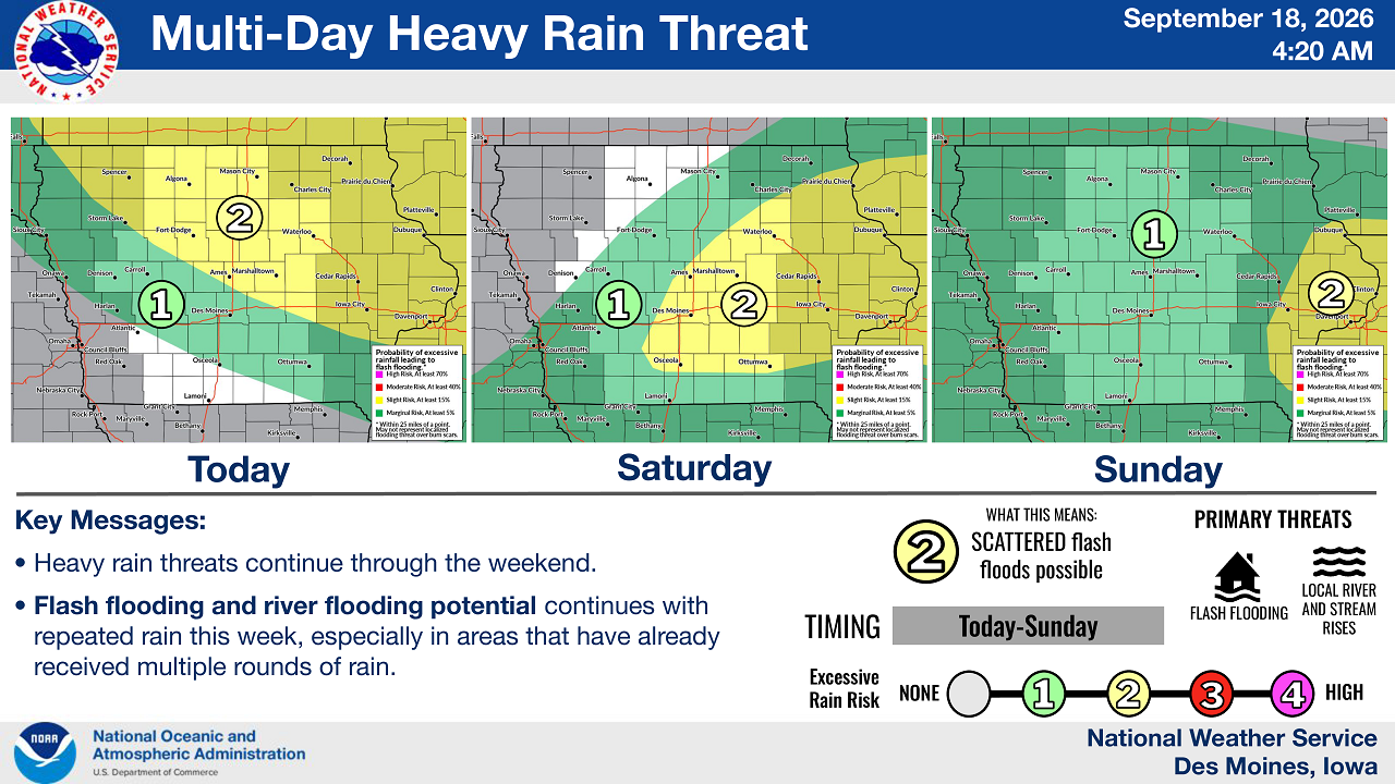
MASON CITY, Iowa — North Iowa is bracing for multiple rounds of thunderstorms and heavy rainfall through the weekend, with forecasters warning that saturated soils could lead to flash flooding and rising rivers and streams.
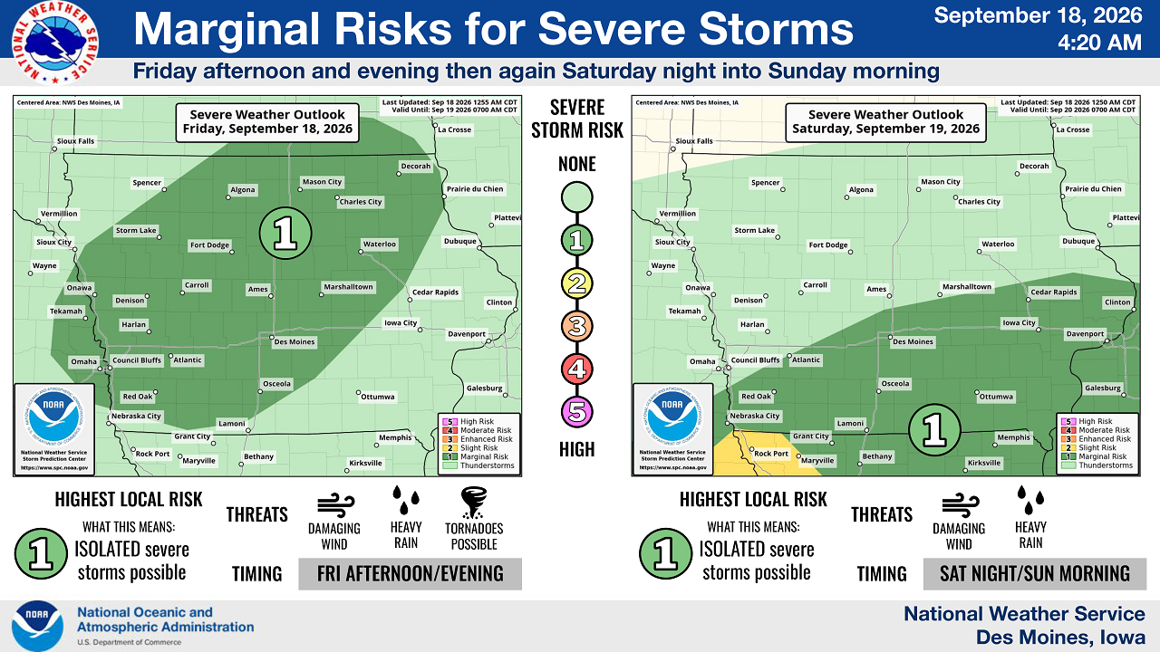
The National Weather Service office in Des Moines said periods of rain will continue through Sunday, with locally heavy rainfall possible at times. The agency also expanded its marginal severe storm risk area Thursday to include a wider swath of the region.
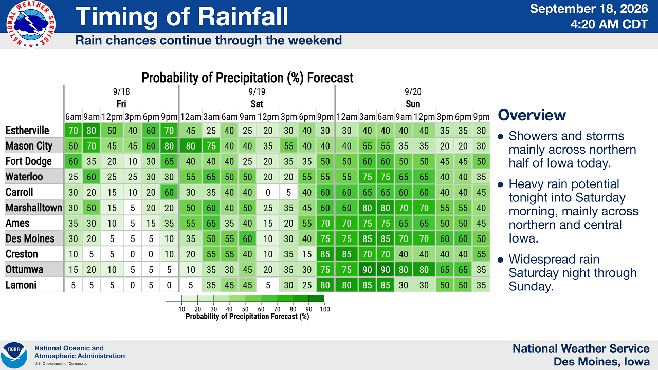
Showers and storms are expected mainly across the northern half of Iowa on Friday, according to the weather service. Heavy rain potential increases Friday night into Saturday morning, mainly across northern and central Iowa, before widespread rain moves in Saturday night through Sunday.
In Mason City, forecasters put the chance of rain at 70% Friday morning, dropping through the afternoon before climbing to 80% by 9 p.m. Friday. Rain chances remain elevated into Saturday, at 80% overnight and 75% by midmorning, before tapering off Saturday afternoon. A renewed chance of rain returns late Saturday night into Sunday morning, with a 55% chance around 3 a.m. Sunday.
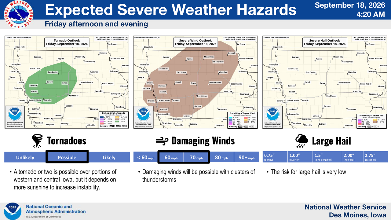
Forecasters said a marginal risk for severe storms — the lowest tier on the weather service’s five-point scale — covers a broad stretch of the state Friday afternoon and evening, with isolated severe storms possible. Damaging wind gusts of 60 to 70 mph are the primary threat with clusters of thunderstorms, according to the weather service. The risk for large hail remains very low.
A tornado or two is possible over portions of western and central Iowa Friday, the weather service said, though that risk depends on enough afternoon sunshine to increase atmospheric instability. A second round of isolated severe storms is possible Saturday night into Sunday morning, mainly across central and eastern Iowa.
With ground already saturated from previous rounds of rain, forecasters warned that additional rainfall this week raises the risk of flash flooding and river or stream rises, particularly in areas that have seen repeated heavy rain.
The weather service urged residents not to drive through moving or standing water, noting that it takes only 6 inches of flowing water to sweep a person off their feet. If a road is not visible or is barricaded, drivers should turn around rather than attempt to pass, the agency said.
Stay Connected with 95.1 The Bull
Add 95.1 The Bull as a preferred source on Google to see more local news, weather, and sports in your feed.
Follow us on Facebook for breaking news, severe weather alerts, sports, and more.