


Flood Watch, Severe Storm Threat to Bring Heat, Heavy Rain and Wind to North Iowa Through Holiday Weekend
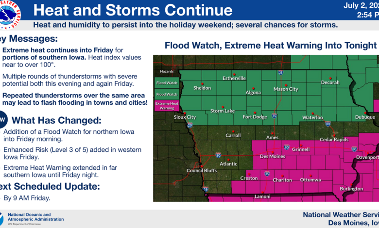
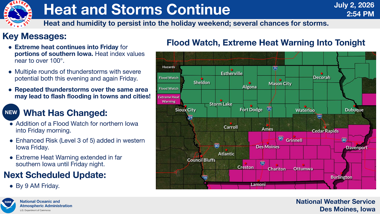
MASON CITY — North Iowa residents should prepare for a stretch of unsettled weather heading into the holiday weekend, as the National Weather Service in Des Moines has issued a Flood Watch and outlined multiple rounds of severe thunderstorms expected today into Friday.
According to the latest NWS briefing issued Thursday, July 2, extreme heat and humidity will persist across the region, with several chances for storms capable of producing damaging wind, large hail, heavy rain, and isolated tornadoes.
Flood Watch Now in Effect for Mason City and Surrounding Counties
A Flood Watch has been issued for northern Iowa, including Mason City, Algona, Decorah, Sheldon, Storm Lake, and Estherville, and remains in effect into Friday morning. Meanwhile, an Extreme Heat Warning covers southern Iowa communities such as Des Moines, Ames, Cedar Rapids, Ottumwa, and Burlington through Friday night, with heat index values expected to reach or exceed 100 degrees.
Key takeaways from the National Weather Service:
- Extreme heat continues into Friday for southern Iowa, with heat index values near or above 100 degrees.
- Multiple rounds of thunderstorms with severe potential are expected both this evening and again Friday.
- Repeated thunderstorms tracking over the same areas could lead to flash flooding in towns and cities across North Iowa.
- The next scheduled NWS update is expected by 9 a.m. Friday.
What Changed Today
Forecasters added the Flood Watch for northern Iowa overnight into Friday morning as rain chances increased across the region. The Storm Prediction Center also expanded an Enhanced Risk (Level 3 of 5) for severe weather into western Iowa for Friday, while the Extreme Heat Warning in far southern Iowa was extended through Friday night.
Severe Storm Threat Tonight
Thunderstorms are expected to develop this afternoon and continue into the evening, with the potential for additional storms overnight into Friday morning, especially across northern Iowa. Much of North Iowa — including Mason City, Algona, Charles City, and Decorah — falls under a Slight Risk (Level 2 of 5) for severe weather Thursday, with the greatest threat expected before 8 p.m. and again after 3 a.m.
Primary threats include:
- Damaging wind gusts, isolated up to 80 mph in the hardest-hit areas
- Large hail, with 1 to 2 inches in diameter possible in the strongest storms
- Heavy rainfall
- A tornado or two, mainly north of Highway 30
Storms are forecast to move northeast at around 30 mph.
Friday Brings Another Round of Storms
The threat doesn’t end with Thursday night. A second severe weather outlook shows numerous storms possible Friday, particularly across western Iowa, where an Enhanced Risk (Level 3 of 5) has been issued for areas including Storm Lake, Sioux City, and Council Bluffs. Mason City and much of North Iowa remain under a Slight Risk (Level 2 of 5) for Friday, with multiple rounds of storms possible during the morning and evening hours as the system tracks east at 25 to 30 mph.
Primary threats Friday include damaging wind, large hail, and heavy rain, with tornadoes listed as a secondary threat.
Flash Flooding Possible Both Days
The National Weather Service is also highlighting a flash flood risk for North Iowa on both Thursday and Friday. Rainfall totals of 1 to 3 inches are possible, mainly across northern Iowa, with isolated higher amounts. Slow-moving, repeated rounds of thunderstorms raise the risk of flash flooding in towns, cities, and along local rivers and streams, with rain chances continuing into Saturday.
What North Iowa Residents Should Do
The National Weather Service is urging residents across North Iowa to stay weather aware heading into the holiday weekend:
- Monitor outdoor plans. If storms are in the forecast, have a backup plan for holiday gatherings, fireworks, and other outdoor activities.
- Have multiple ways to receive warnings, including a weather radio or phone alerts, in case storms develop overnight.
- Know where to take shelter indoors away from windows if a warning is issued for your area.
- Avoid driving through flooded roadways, as flash flooding can develop quickly in low-lying areas and near creeks and streams.
The National Weather Service in Des Moines says it will issue its next full update by 9 a.m. Friday as forecasters continue to monitor the evolving severe weather and flooding threat across Iowa.


Stay Connected with 95.1 The Bull
Add 95.1 The Bull as a preferred source on Google to see more local news, weather, and sports in your feed.
Follow us on Facebook for breaking news, severe weather alerts, sports, and more.