


North Iowa Heat Wave Continues Through July 4th Weekend; Severe Storms Possible Wednesday and Thursday
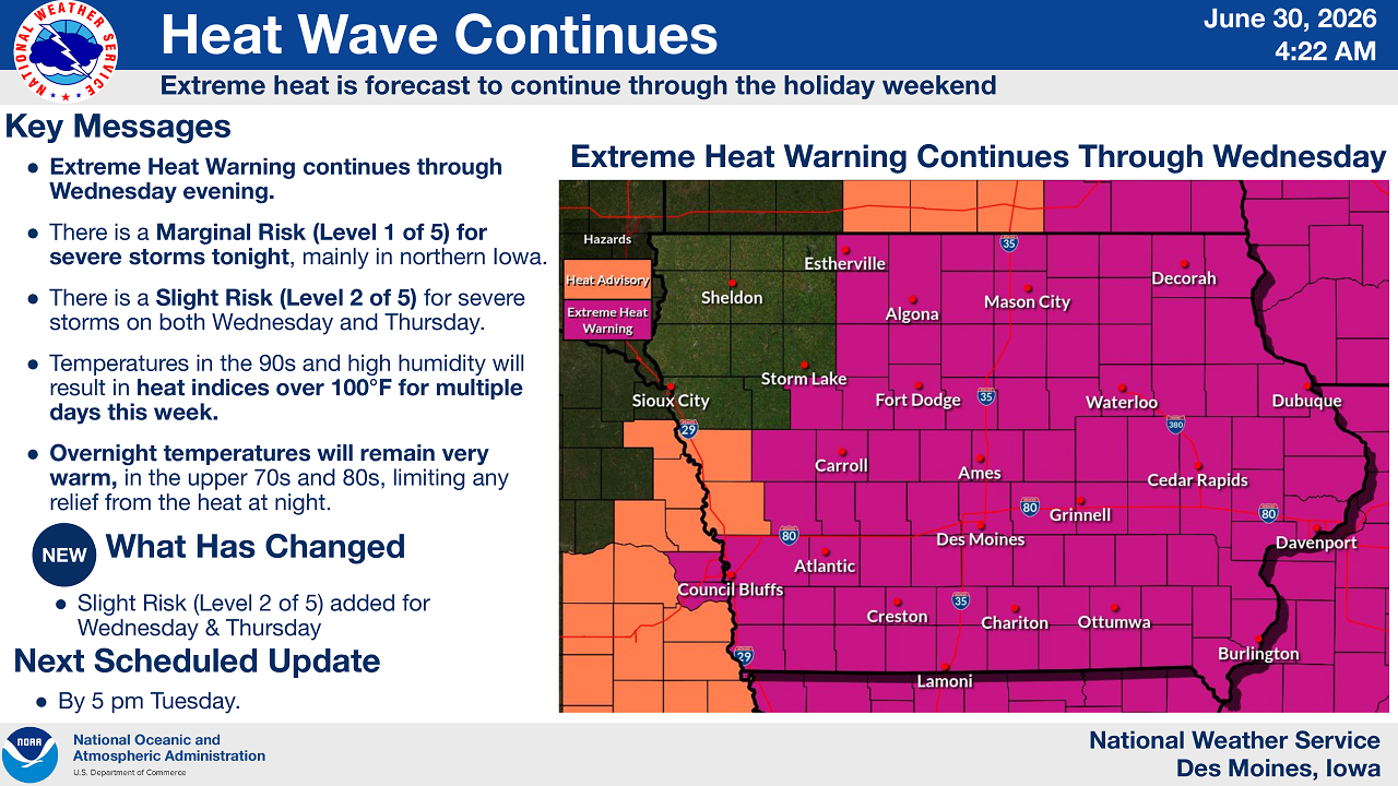
MASON CITY, IOWA – Mason City and North Iowa remain under an Extreme Heat Warning that the National Weather Service says will last through Wednesday evening, with dangerously high heat index values expected to linger into the Independence Day holiday weekend.
According to the latest outlook issued by the National Weather Service office in Des Moines at 4:22 a.m. Tuesday, extreme heat will continue to grip nearly all of North Iowa, including Mason City, Algona, Estherville, Decorah, Fort Dodge and Waterloo, all of which sit inside the Extreme Heat Warning zone. Far western counties near Sioux City and Sheldon remain under a less severe Heat Advisory.
Heat Index Could Top 100 Degrees for Days
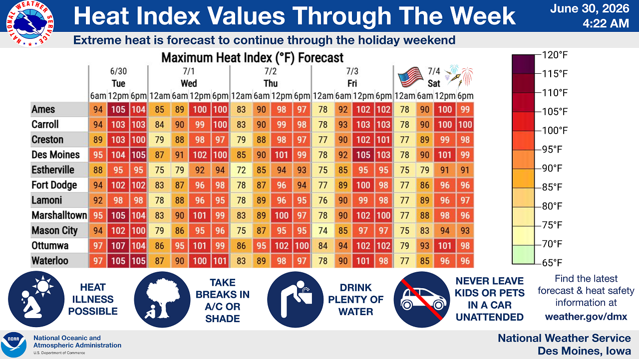
Temperatures in the 90s combined with high humidity will push heat index values above 100 degrees on multiple days this week, forecasters said. Mason City itself is forecast to see a maximum heat index near 102 degrees Tuesday afternoon, with little overnight relief: lows are expected to stay in the upper 70s and 80s, meaning the heat will barely ease even after sunset.
The hottest conditions across the region are expected in Ottumwa and Des Moines, where heat index values could approach 107 degrees Tuesday afternoon, but North Iowa communities won’t be spared. Forecast heat index values for Tuesday through Saturday, July 4, show a gradual, slight cooling trend by midweek before heat builds again heading into the holiday weekend.
The National Weather Service says its next full update on the heat warning will come by 5 p.m. Tuesday.
New Storm Risk Added for Wednesday and Thursday
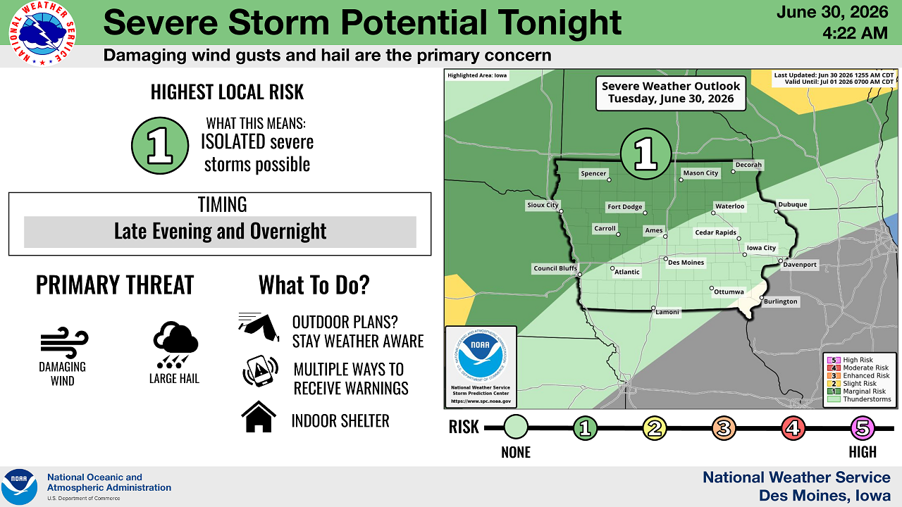
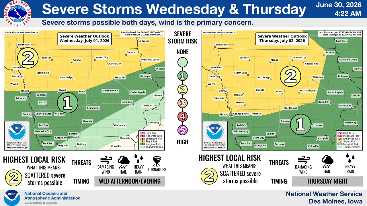
In a change from earlier forecasts, the Weather Service has now added a Slight Risk (Level 2 of 5) for severe thunderstorms across much of North Iowa, including Mason City, for both Wednesday afternoon and evening and again Thursday night. Damaging wind gusts and large hail are the primary threats with these storms, though isolated heavy rain and an isolated tornado cannot be ruled out.
Tonight (Tuesday into Wednesday), a smaller Marginal Risk (Level 1 of 5) for isolated severe storms covers northern Iowa, with the greatest chance of thunderstorms arriving late evening and overnight. Forecasters are urging residents to stay weather-aware if they have outdoor plans, keep multiple ways to receive warnings on hand, and be ready to move to indoor shelter if storms approach.
Heat Safety Tips for North Iowa Residents
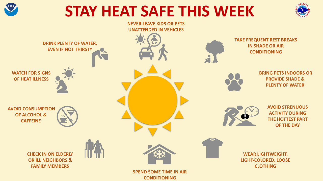
With dangerous heat expected to persist for several more days, the National Weather Service is urging residents across North Iowa to take precautions, including:
Drinking plenty of water throughout the day, even when not thirsty. Taking frequent breaks in air conditioning or shade, especially during the hottest part of the afternoon. Never leaving children or pets unattended in vehicles, even for a few minutes. Wearing lightweight, light-colored, loose-fitting clothing. Avoiding alcohol and caffeine, which can worsen dehydration. Checking in on elderly neighbors, relatives, and anyone without reliable air conditioning. Watching for early signs of heat illness, such as heavy sweating, dizziness, or nausea, and seeking shade or cooling immediately if symptoms appear.
Pet owners are also reminded to bring animals indoors when possible or ensure they have ample shade and water if kept outside.
What’s Next
The Weather Service says it will continue to monitor both the extreme heat and the developing severe storm threat as North Iowa heads toward the July 4th holiday.
Stay Connected with 95.1 The Bull
Add 95.1 The Bull as a preferred source on Google to see more local news, weather, and sports in your feed.
Follow us on Facebook for breaking news, severe weather alerts, sports, and more.