


Health & LivingNewsOutdoorsWeather
North, Northeast Iowa to Go Under Winter Storm Warning, Ice Storm Warning for Areas South
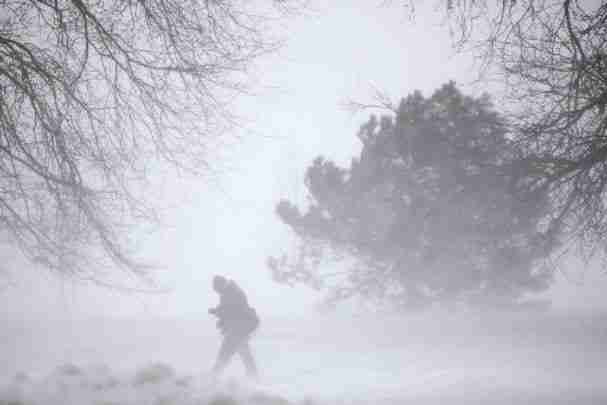
These are the latest weather warnings from the National Weather Services in Lacrosse and Des Moines
URGENT - WINTER WEATHER MESSAGE
National Weather Service La Crosse WI
236 PM CST Tue Feb 21 2023

...Snow Is Moving Toward The Area This Afternoon...

.Snow continues to move into southeast Minnesota this early
afternoon and will continues to spread further eastward heading
into this evening. Visibilities are below one mile in some spots
within the snow, and accumulations occurred rapidly after the snow
began.

A band of 5 to 8 inches of snow is still expected north of
Interstate 90 through the I-94 corridor. Snow amounts will
decrease very quickly south of I-90. Blowing and drifting snow
Wednesday morning is expected as winds increase.

The second and stronger wave of snow arrives from south to north
Wednesday across the entire area. By the time the storm ends late
Thursday, an additional 8 to 12 inches of snow is expected
northwest of an Austin, Minnesota to Necedah, Wisconsin line.
sleet and freezing rain are a expected south of this line. Ice
amounts from 1 to 3 tenths of an inch are possible along and
south of the Highway 18 corridor beginning early Wednesday
afternoon lasting until Thursday morning with the risk of tree
and power line damage amplified by winds gusting to 30 to 40 mph.

This will be a HIGHLY impactful winter storm with travel severely
impacted at times.

IAZ008>011-018-019-WIZ054-055-220600-
/O.UPG.KARX.WS.A.0004.230222T1800Z-230224T0000Z/
/O.EXB.KARX.WS.W.0003.230222T1500Z-230224T0000Z/
Mitchell-Howard-Winneshiek-Allamakee-Floyd-Chickasaw-Crawford-
Richland-
Including the cities of Osage, Cresco, Decorah, Waukon,
Charles City, New Hampton, Prairie Du Chien, and Richland Center
236 PM CST Tue Feb 21 2023

...WINTER STORM WARNING IN EFFECT FROM 9 AM WEDNESDAY TO 6 PM CST
THURSDAY...

* WHAT...Heavy mixed precipitation expected. Total snow
  accumulations of 2 to 7 inches and ice accumulations of up to
  one tenth of an inch. Winds gusting as high as 40 mph.

* WHERE...Portions of north central and northeast Iowa and
  southwest Wisconsin.

* WHEN...From 9 AM Wednesday to 6 PM CST Thursday.

* IMPACTS...Travel could be very difficult. Patchy blowing snow
  could significantly reduce visibility. The hazardous conditions
  could impact the morning or evening commute.

PRECAUTIONARY/PREPAREDNESS ACTIONS...

If you must travel, keep an extra flashlight, food, and water in
your vehicle in case of an emergency.

In Iowa, visit 511ia.org for road conditions. In Wisconsin,
visit 511wi.gov for road conditions.
URGENT - WINTER WEATHER MESSAGE
National Weather Service Des Moines IA
217 PM CST Tue Feb 21 2023

...Significant Winter Storm Wednesday Into Thursday...

.A large storm system will produce hazardous winter travel
conditions across central and northern Iowa. Precipitation will
begin mid-morning Wednesday and continue into Thursday. Heavy
snowfall is likely in far northern Iowa with accumulations pushing
8 inches or more close to the Minnesota and Iowa state border.
Strong winds will further aggravate difficult driving conditions
by producing widespread blowing snow and visibility reductions to
near a quarter mile at times. Mixed precipitation types are more
of a concern to the south in central Iowa with a variety of snow,
freezing rain, and sleet all possible. Ice accretions may approach
or exceed a quarter inch over portions of central and east-
central Iowa.

IAZ004>007-015>017-220430-
/O.EXT.KDMX.WS.W.0004.230222T1500Z-230224T0000Z/
Emmet-Kossuth-Winnebago-Worth-Palo Alto-Hancock-Cerro Gordo-
Including the cities of Estherville, Algona, Forest City,
Lake Mills, Northwood, Manly, Emmetsburg, Garner, Britt, Kanawha,
Mason City, and Clear Lake
217 PM CST Tue Feb 21 2023

...WINTER STORM WARNING NOW IN EFFECT FROM 9 AM WEDNESDAY TO 6 PM
CST THURSDAY...

* WHAT...Heavy mixed precipitation expected. Total snow
  accumulations of 4 to 10 inches and ice accumulations of around
  one tenth of an inch. Highest snow totals near the state
  border. Winds gusting as high as 40 mph.

* WHERE...Far north central Iowa.

* WHEN...From 9 AM Wednesday to 6 PM CST Thursday.

* IMPACTS...Travel could be very difficult. Patchy blowing snow
  could significantly reduce visibility. The hazardous
  conditions could impact the morning or evening commute.

PRECAUTIONARY/PREPAREDNESS ACTIONS...

If you must travel, keep an extra flashlight, food, and water in
your vehicle in case of an emergency.

For the latest travel conditions, check the Iowa 511 app,
www.511ia.org, or dial 511.
URGENT - WINTER WEATHER MESSAGE
National Weather Service La Crosse WI
236 PM CST Tue Feb 21 2023

...Snow Is Moving Toward The Area This Afternoon...

.Snow continues to move into southeast Minnesota this early
afternoon and will continues to spread further eastward heading
into this evening. Visibilities are below one mile in some spots
within the snow, and accumulations occurred rapidly after the snow
began.

A band of 5 to 8 inches of snow is still expected north of
Interstate 90 through the I-94 corridor. Snow amounts will
decrease very quickly south of I-90. Blowing and drifting snow
Wednesday morning is expected as winds increase.

The second and stronger wave of snow arrives from south to north
Wednesday across the entire area. By the time the storm ends late
Thursday, an additional 8 to 12 inches of snow is expected
northwest of an Austin, Minnesota to Necedah, Wisconsin line.
sleet and freezing rain are a expected south of this line. Ice
amounts from 1 to 3 tenths of an inch are possible along and
south of the Highway 18 corridor beginning early Wednesday
afternoon lasting until Thursday morning with the risk of tree
and power line damage amplified by winds gusting to 30 to 40 mph.

This will be a HIGHLY impactful winter storm with travel severely
impacted at times.

IAZ029-030-WIZ061-220600-
/O.UPG.KARX.WS.A.0004.230222T1800Z-230224T0000Z/
/O.NEW.KARX.IS.W.0002.230222T1500Z-230224T0000Z/
Fayette-Clayton-Grant-
Including the cities of Oelwein, Elkader, and Platteville
236 PM CST Tue Feb 21 2023

...ICE STORM WARNING IN EFFECT FROM 9 AM WEDNESDAY TO 6 PM CST
THURSDAY...

* WHAT...Significant icing expected. Ice accumulations of one
  tenth to three tenths of an inch. Total snow accumulations of up
  to 3 inches across the northern portions of the counties to less
  than an inch across the south. Winds gusting as high as 40 mph.

* WHERE...In Iowa, Fayette and Clayton Counties. In Wisconsin,
  Grant County.

* WHEN...From 9 AM Wednesday to 6 PM CST Thursday.

* IMPACTS...Power outages and tree damage are likely due to the
  ice. Travel could be nearly impossible. The hazardous
  conditions could impact the morning or evening commute.

PRECAUTIONARY/PREPAREDNESS ACTIONS...

Travel is strongly discouraged. If you must travel, keep an extra
flashlight, food and water in your vehicle in case of an
emergency. Prepare for possible power outages.

In Iowa, visit 511ia.org for road conditions. In Wisconsin,
visit 511wi.gov for road conditions.
URGENT - WINTER WEATHER MESSAGE
National Weather Service Des Moines IA
217 PM CST Tue Feb 21 2023

...Significant Winter Storm Wednesday Into Thursday...

.A large storm system will produce hazardous winter travel
conditions across central and northern Iowa. Precipitation will
begin mid-morning Wednesday and continue into Thursday. Heavy
snowfall is likely in far northern Iowa with accumulations pushing
8 inches or more close to the Minnesota and Iowa state border.
Strong winds will further aggravate difficult driving conditions
by producing widespread blowing snow and visibility reductions to
near a quarter mile at times. Mixed precipitation types are more
of a concern to the south in central Iowa with a variety of snow,
freezing rain, and sleet all possible. Ice accretions may approach
or exceed a quarter inch over portions of central and east-
central Iowa.

IAZ026>028-037>039-220430-
/O.UPG.KDMX.WW.Y.0006.230222T1800Z-230224T0000Z/
/O.NEW.KDMX.IS.W.0002.230222T1500Z-230224T0000Z/
Franklin-Butler-Bremer-Hardin-Grundy-Black Hawk-
Including the cities of Hampton, Parkersburg, Clarksville,
Shell Rock, Greene, Aplington, Allison, Dumont, Waverly,
Iowa Falls, Eldora, Ackley, Grundy Center, Reinbeck, Conrad,
Dike, Wellsburg, Waterloo, and Cedar Falls
217 PM CST Tue Feb 21 2023

...ICE STORM WARNING IN EFFECT FROM 9 AM WEDNESDAY TO 6 PM CST
THURSDAY...

* WHAT...Significant icing expected. Total snow and sleet
  accumulations of up to two inches and ice accumulations of one
  tenth to three tenths of an inch. Winds gusting as high as 45
  mph.

* WHERE...Portions of east-central Iowa

* WHEN...From 9 AM Wednesday to 6 PM CST Thursday.

* IMPACTS...Power outages and tree damage are likely due to the
  ice. Travel could be nearly impossible. The hazardous
  conditions could impact the morning or evening commute.

PRECAUTIONARY/PREPAREDNESS ACTIONS...

Travel is strongly discouraged. If you must travel, keep an extra
flashlight, food and water in your vehicle in case of an
emergency. Prepare for possible power outages.

For the latest travel conditions, check the Iowa 511 app,
www.511ia.org, or dial 511.