


Updated 6/25/22 at 12:13 am
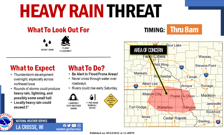
Showers and thunderstorms have developed across central to eastern Iowa. The line of storms extends from Fort Dodge in north central Iowa east to Iowa City. While there is a possibility of a strong to severe thunderstorm, the main concern is heavy rainfall. The Weather Prediction Center says the possibility exists for rainfall rates of 2 to 3 inches per hour within the thunderstorms which could cause localized short term flooding, including rises on area rivers.
WEATHER FORECAST – AREA WEATHER ALERTS
RECENT STORM REPORTS – LATEST RIVER LEVELS